Shaping sites through Space Syntax
Dr. Justyna Olesiak, Site Selection Specialist & Architect
Introducing the language of Space Syntax
Justyna’s PhD investigates how advanced urban analysis tools support informed planning decisions. Her dissertation focuses on Nowy Sacz, in Poland her home city; the place where she also spent several professional years within the Municipal Architectural Department.
The research is built around Space Syntax, an analytical tool for examining how streets and spaces are connected, how movement flows through a city, and how spatial configuration shapes everyday urban life.
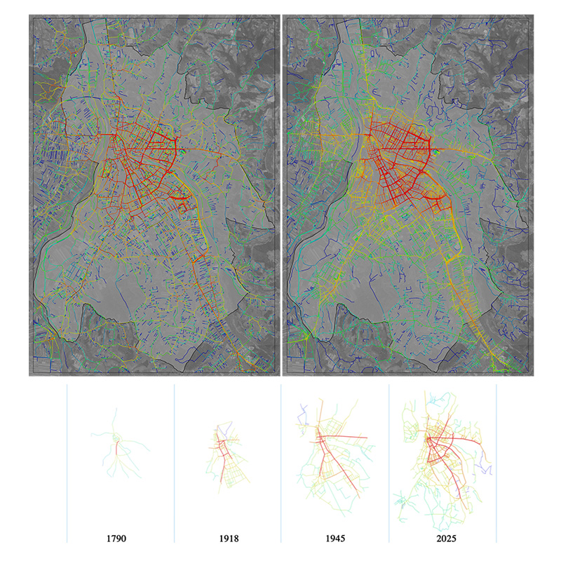
Working with archival and contemporary maps, Justyna reconstructed the growth of Nowy Sacz from its earliest documented layouts to today. This allowed her to identify which streets have remained structurally important over long periods and how the city’s spatial logic has evolved.
© Dr. Justyna Olesiak
Testing Space Syntax on proposed developments
A core component of the thesis focuses on three large properties owned by the city. These sites had previously been the subject of architectural competitions, generating multiple design proposals that were never fully implemented.
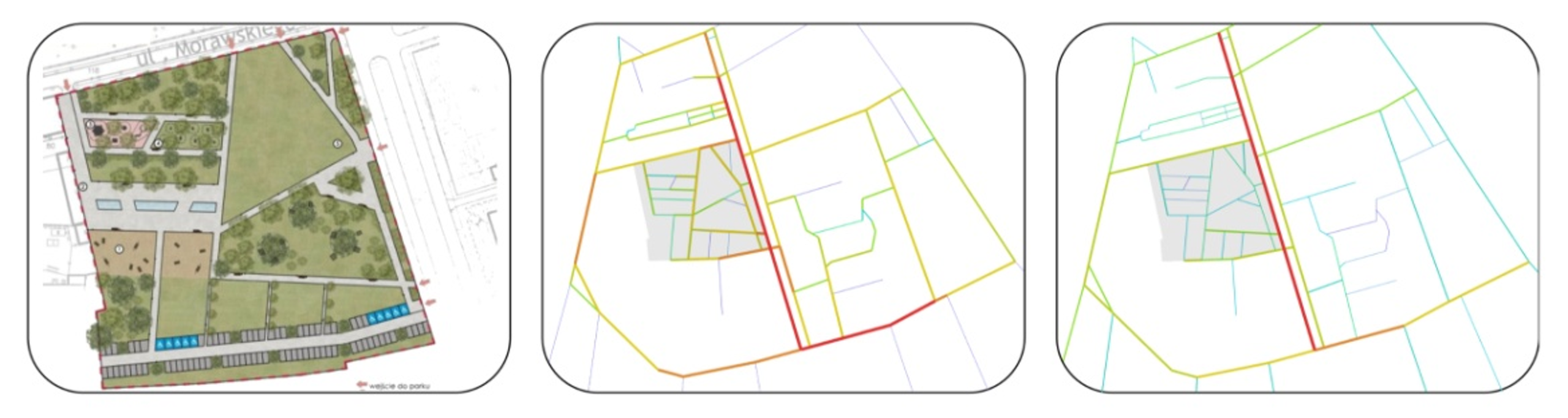
For one of these properties, Justyna selected three of the strongest competition concepts and subjected them to detailed Space Syntax analysis. She examined how each option would influence connectivity, movement patterns, and the relationship between the site and its surroundings.
© Dr. Justyna Olesiak
By linking these findings to her experience in the municipal architectural department, Justyna shows how Space Syntax can be embedded in everyday municipal decision-making.
Applying Space Syntax to our site selection
“My PhD work trained me to look at sites not just as isolated plots, but as parts of a wider urban system. When I evaluate a potential data center location at GARBE.DC, I think about connectivity, movement, long-term usage and how decisions on one property ripple out into the surrounding area. The ability to engage with long-term planning scenarios, not just current connectivity analysis has particular value from the 10-20 year investment perspective.
Overall, these tools and mindset help me translate complex planning conditions and spatial constraints into clear, realistic concepts for our projects.
Working with historic maps, space syntax and municipal processes has made me very comfortable navigating between technical analysis, regulation, and real-world development pressures. At GARBE.DC, that means I can read a site quickly, understand how a city is likely to respond, and prepare material that speaks both to planners and to investors. The research discipline from my PhD also helps – it keeps me structured, evidence-based, and focused on solutions that will still make sense for the city many years from now.”